|
|
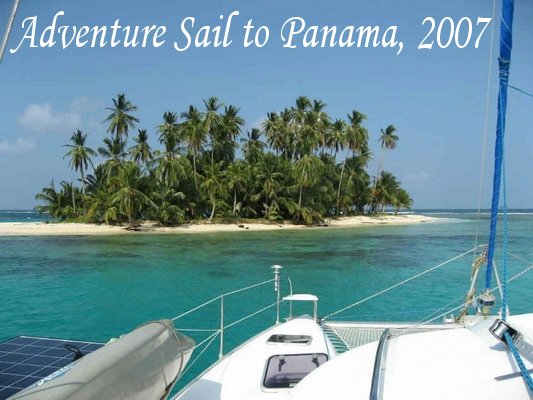 |
|
Use
the Navigation Area to the left to cruise along with us
Check out Stray Cat Charters at http://www.SailStrayCat.com
------------- UPDATE - October
31, 2007 -------------
The website has been updated. Journal updates
are located on the appropriate pages which are accessible using the
Navigation pane on the left.
------------- UPDATE - October
19, 2007 -------------
The passage from Jamaica to Panama was supposed to
be a beam reach through the trade wind belt. Pilot Charts are
reference books that show what the recorded wind and wave information
are for the last 100 years in most oceans and bodies of water. The
Pilot Charts indicate that during the month of October on the passage
from Jamaica to Panama that the wind blows out of the east at 15-20
knots about 90 percent of the time. Well, we seemed to find 100%
of the 10% of the time that the wind did not blow. We were able to
sail for several hours here and there, using squalls and localized
micro-fronts to slingshot us 10 or 15 miles, but on the whole the trades
never filled in.
On the second and third day, we did pick up some
wind, but it was straight out of the south and right on the nose.
We spent the better part of 24 hours tacking – first southeast and
then southwest, but we found this to be futile as a substantial current
was against us on the southeast tack. During those 24-30 hours we
made only 15-20 miles of southing, and eventually realized that this
tactic was not going to be successful.
At this point, we were forced to make plans based
on the fact that if the wind never did cooperate, we were facing a
serious issue, as we most likely didn’t have enough fuel to motor the
entire distance. As a result, we began using only one engine at a
time, always keeping the RPMs in the 1500-2000 range in order to
conserve fuel. At low RPMs, the engines become very fuel
efficient, and even though we rarely moved at over 4 knots, we surmised
that this was our best bet at making landfall any time soon.
And so it went for close to 300 miles.
Sunrise became morning – morning became afternoon – afternoon became
dinner – dinner became sundowners – sundowners became talking about
the night watch schedule – a little sleep – a few hours on watch –
a little more sleep – and sunrise came to start it all over again.
All the while, we prognosticated, forecasted, made assumptions, made
predictions, read weather books, studied the clouds, and even said a few
prayers – all focused on the big question – “Where are the
trades?"
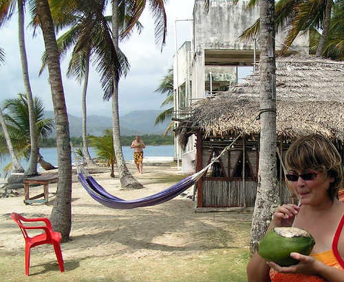
The Dinghy Push Project
With 120 miles to go, we realized that we could no
longer make any plans that included hoping for the wind – there was
none. We knew that we were low on fuel so we started doing some
calculations to see just what our situations was, and the result was
that making landfall on the diesel that we had was questionable at best.
So, the last resort option came out and after a few
hours of discussion, we decided to pull the trigger. We stopped
the boat, lowered the dinghy and moved it around to the starboard side
of the boat and rigged a spring line from Stray Cat’s aft cleat
to a padeye on the front of the dinghy. We then rigged the
dink’s bowline to Stray Cat’s bow cleat. When all was
tight and looked right, we revved up the Yamaha 15hp, and off we went
– at a blistering 2.5 knots. The dink was doing an admirable job
pushing us along, and for as long as we could keep that Yamaha running,
we could move along at 2 to 3 knots without running the diesels, thereby
conserving fuel that we would need to make landfall and enter the
harbor. We also had a nice current of 1 knot and managed to stay
between 3 & 4 knots most of the time. We were carrying
approximately 14 gallons of gasoline on board, but none of us were sure
of how long that amount would last because none of us had much
experience pushing a 22,000 pound boat with a 15 hp outboard
motor.
We started with the “Dinghy Push Project” at
about 9am on Sunday morning. At about 11am, a squall came up and
we were able to get the genny out and pulling for about 2 hours, which
helped the dink get us up to 5 or 6 knots. Finally, at around 5pm,
the first 4 gallon fuel tank ran dry, and we switched to our second 4
gallon tank. Then right before dark at about 7pm, we switched to
the larger 6 gallon tank so that we would have the least possible chance
of having to make any adjustments to the dinghy during the night, when
it would be infinitely more dangerous. We “motored” through
the dark for hours, and then at 5am, on Capt. Mark’s watch, the Yamaha
finally sputtered and died. Back to slow motoring on one diesel
engine until sun-up, but by that time, we had come within 30 miles of
Panama, and because of the heroic actions of our little 10 ft dinghy and
15hp Yamaha, we were now pretty confident that we had enough fuel to
make landfall and get into port. The dink had pushed us for almost
24 hours and helped us make almost 60 miles. Not quite as good as
having the trade winds on the beam, but it got the job done. The
next morning we tried to get the dinghy going again, but the motor
wouldn’t start – it seems that during the night, the strengthening
waves had splashed into the dinghy and some water had entered the fuel
tank. Capt Mark proceeded to take apart the carburetor and clean
it at least twice – all while underway, but alas, it didn’t help as
the gasoline was now contaminated. Oh well, at least we made it to
Panama.
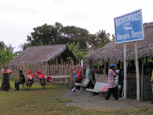
Landfall in Panama!!
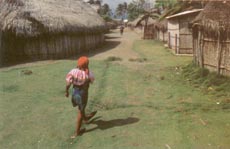
Stray Cat and crew made landfall in Panama
on Monday morning at approximately10am. We pulled into a place
called Miramar because one of our guide books told us that they had a
fuel dock, and that was important to us. We spent six days making
the passage from Jamaica to Panama, most of it waiting for the trade
winds to fill in. We were forced to motor for a large percentage
of the time, and we were quickly realizing that by the time we were
close to Panama, we would be on fumes. We knew that there would be
no diesel available in the San Blas Islands because they are so remote,
so we were forced to change course to make landfall about 25 miles from
our original destination. Our new destination was a small harbor
town called Miramar, where we hoped to refuel before heading to San
Blas.
We shot the approach into Miramar – a reef on the
left and rocks on the right. We made it around the reef and began
to make our way down the channel towards the few docks and buildings
that we thought was our destination. It seems that we were a
little left of the channel, however, because just after a local whistled
at us and motioned us further to the right, we lost water and the boat
came to a stop rather quickly – we were aground. So much for a
graceful entrance, but Capt. Mark stayed calm and skillfully used Stray
Cat’s twin props to wiggle off the ground and back into deep
water. Ok – let’s try this again. We moved the boat very
close to shore and made a few inquiries about where we could get diesel
and gasoline – our first foray into our “Spanish to Survive”
course, and shortly thereafter we found what we had come for.
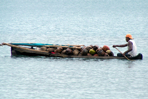
What we found in Miramar was a very small warehouse
near the water, with a dock that can only be described as “rickety”,
and a small store, or “tienda” run by a very cordial Chinese family.
When we arrived all of the locals were on the dock loading down with
supplies to take to the small villages of San Blas. We waited for
a space at the “dock” for over an hour as they loaded all kinds of
sodas, beers, flour, sugar, rice, bananas and fuel onto their small
panga style local boats. It was finally our turn to move in, and
thanks to some great maneuvering and crew work, we pulled off the tight
squeeze and tied the bow up into the mangroves. After a few
“preguntas” from the young Asian man working the dock, down the pier
rolled the diesel – on a hand truck inside a 55 gallon drum. We
positioned the boat on the dock to get close to the drum and used a hand
cranked pump to fill the port tank, but had to move the boat off the
dock and flip her around to get to the starboard tank. We bought
every bit of diesel they had which amounted to about 75 gallons, which
we figured would be enough to last us during our trip through the San
Blas.
They also had groceries and supplies at the small
tienda, so we spent some time and money provisioning for San Blas before
we left. They had a limited supply, but a few key items were
necessary since we were picking up a new passenger the next day and we
were very low on food. The prices were reasonable, the people were
friendly, and our first contact with Panamanian culture was pretty
enjoyable. It was a Godsend to have been able to obtain fuel,
meat, milk, cereal, soda, eggs etc.. Most of all, though, it
was very nice to have the long, windless passage behind us. Off to
the San Blas Islands!
Checking in to Panama
Leaving Miramar, we turned east and followed the
Atlantic coast of Panama towards Punta San Blas and the outlying islands
of Kuna Yala. We were heading for an island called Isla Porvenir,
which is an official Panamanian Customs and Immigration check in
location, but what makes it different is that it is run by the Kuna
Indians, and as a result, it has a reputation for being a much
friendlier and less bureaucratic place to check in – much better than
Colon. We had hoped to get there Monday afternoon in time to take
care of the check in with the officials before they retired for the day,
but our estimated time of arrival was past five ‘o clock local time.
As we approached, Mike got on the VHF radio and called Porvenir.
The Customs & Immigration officials answered on the radio and said
they could accommodate us, but with overtime charges of $20. No
Problem Mon! We anchored next to Porvenir just past 5pm and Capt
Mark hurried over in the dinghy to meet Eduardo. Capt Mark was
headed towards the town dock in the dinghy when a man from an anchored
sailboat flagged him down. Mark stopped over and the man
introduced himself as Eduardo Lopez. They both made way to the
town dock and after filling out a ton of paperwork, Capt Mark had the 4
of us and Stray Cat checked in for 3 months! Wahoo!!
We celebrated that night with a few rums and a great dinner. It
was wonderful to all be able to sleep through the night without having
to stand watches and battle squalls and freighters. The sleep
didn’t last long however, as we had to make sure that we were awake to
pick up Walter at 6:30am from the Porvenir airport.
We were all up early the next day, Tuesday the
16th, preparing for Walter’s arrival. We were having our morning
coffee in the cockpit, when we heard an airplane flying above us.
We watched the pilot’s deft maneuvering as he landed the twin engine,
high wing, turbo prop at the Porvenir airport. Capt Mark sped over
in the dinghy to greet Walter and he was back in about 15 minutes with
no Walter. We decided that Walter had missed his flight when we
heard the familiar sound of engines overhead. Another of the same
kind of twin engine buzzed the anchorage and then landed. Another
plane!
This time, we thought, Walter must be aboard, so
Capt. Mark, Mike and Kate dinked over to collect our new crew member.
Sure enough, we found him just as advertised, with his video camera,
already filming the buildings and uniqueness of Porvenir. And so
we added Walter – a Russian who has lived in Moscow and St.
Petersburg, but now works in NY and LA. Walter is making a
documentary film about the San Blas Islands, and Stray Cat and
crew will be his transportation and production support team for the week
or so that he is on board.
And so, with a new member on board, Stray Cat
raised anchor and began the next chapter in the Panama Adventure.
------------- UPDATE - October
9, 2007 -------------
We arrived in Port Antonio, Jamaica on Friday,
October 5th in the morning just after 8am. We had to check in with
customs & immigration so we took a slip at the Erroll Flynn
Marina. "Mix" was our line handler and he worked for the
marina. One of the many great people we met in Port Antonio.
We tied up and started filling out paperwork. What a job!
The papers had to be filled out 3 different ways and for 5 people, it
was a lot of red tape. We were able to get off of the boat and
walk around the marina only. Lots of us took advantage of the
marina showers and a little shopping at "Things
Jamaican". The first item we picked up was a lb. of coffee
for $1300. We quickly put it down! Then a shirt for over
$900! We knew something was awry, so we asked the store manager
and she told us the exchange rate at the marina was 65J's(Jamaican
Dollars) to $1 U.S. The exchange rate at the ATM in town was more
like 70-1. We spent thousands of dollars everyday, but without all
the guilt, and the ATM receipt gave your balance in J's - we all loved
seeing our bank balances number in the hundreds of thousands of
dollars!!
We were all starving and looking for some lunch
after the first 2 customs agents came & went, although we were still
waiting for the third. Ryan got a suggestion from one of the local
guys to head over to "Kooyah" for some authentic Jamaican
food. We headed out of the main gate of the marina. The
property of the marina was enormous and encompassed a city park open to
the public in the daytime, it was gorgeous. It was like a lush
tropical paradise with every kind of flower and fruit you could
imagine. We did not have to go far to get to Kooyah and it was on
the rooftop, so we toasted Red Stripes for making it this far on our
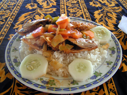
adventure and we ordered, fried Red Snapper, curried chicken &
curried goat! We found goat to be one of the staple meats of the
area. Everything was delicious! From the rooftop we could
see the outdoor market and some really cool old buildings. We were
ready to explore!
We went to the bank to get some more J's when a
local guy named John picked us up. He was a guy who wanted to show
us around town and help us get whatever we needed, sort of an informal
local guide service. John took us all over town showing us all of
the shops, buildings, landmarks, and telling us some of the local
history. He took us through the market where they had all kinds of
fresh fruit and vegetables along with Jamaican trinkets, wood carvings,
leather shoes, Blue Mountain coffee, spices, local meats & fresh
fish. It was awesome! There was so much to see and bargain
for. We went back many times. In the butcher shop a man was
showing us some goat testicles and telling us how good they were for
us. Goat & pig heads were a plenty. Then a
Jamaican lady came and grabbed Ryan and asked him if he was an
Irishman. She was happy to see him and gave him some money to buy
a drink. Ryan was confused and John told him the lady was wealthy
and had English roots, that she had gotten excited at seeing a tall
white man. Ryan promptly was gotten a Red Stripe in the
market. John took us back to the marina after showing us all
around. We tipped him for the service, but he always wanted more
giving us the reason that Jamaican dollars "funny money" .
After chillin' on the boat for a while, Ryan was
ready to bar hop on his last night in Jamaica as he was flying out the
next morning. Ryan & Capt. Mark hit every bar or hole in the
wall in town. Mike, Kate & Stuart went to Shadow's, an outdoor
restaurant downtown, for dinner and had a wonderful fish platter of Mahi
Mahi, steamed vegetables & rice. One plate would have been
enough for 3 people! It was really good and we had a few rums
too. The local rum in Jamaica is Appleton Estates, we got very
familiar with it. As we were finishing up our drinks, John came in
to the bar. He had told us earlier in the day that they had really
good food. He proceeded to take us around the city again.
The first bar we stopped in we saw Capt. Mark & Ryan. We all
had a few drinks and then Kate, Mike & Stuart retired for the
evening and left the night owls up. Ryan had to leave at 8am for a
cab ride to Kingston Airport. We were all up at 8am as he was
leaving, he had scheduled 2 cabs and neither one showed up. There
was a little panic as "Hulk" found a cab for Ryan.
Little did we know at the time - even though Jamaica is in the same time
zone as we are, they do not adjust for Daylight Savings Time, so it was
actually only 7am and at 8am both cabs did show up for Ryan, OOPS!
Saturday was a work day for the Stray Cat
Crew. Capt. Mark & Mike worked on the generator wiring and
fuel pump, they also mounted a pad eye in the deck for the SSB antennae,
then they secured the dinghy with new line. There were a couple of
local guys, Hulk & Donovan, buffing and polishing the hulls for a
few days as it rained on and off the whole time we were in
Jamaica. Stuart & Kate did 6 loads of laundry and went back
and forth to the market 3 times to re-supply the ship's stores.
This was the day we discovered the local bakery & meat pies
Yum! The bakery was very inexpensive and had warm bread fresh from
the oven. Meat pies were the only ground beef we came across in a
cheese flavored Phyllo dough, very tasty! Rum thirty came early
that day as everyone had worked hard. There was a little exploring
of the marina pool and the internet access was really nice. We
were able to use Skype to make a few international calls - it was really
nice to be able to keep in touch for a few days. We called it an
early night as we were all exhausted.
Sunday was another good work day cleaning up the
interior and wrapping up all of the projects on deck. We had a
salon day on the swim platform with haircuts all around for Mike, Kate
& Stuart. We met little Sevaskia Brown, Hulk's daughter, who
hung out on the boat & watched movies while he buffed &
polished. Donovan was still buffing the boat and went to get some
lunch in Boston. A local town well known for their jerk chicken
& pork. It was the best jerked meat we had the whole time in
Jamaica, but it was VERY expensive. Mike & Kate scouted around the
immediate area finding a restaurant nearby and a gorgeous beach with
some historic ruins on the marina property. The flora & fauna
were incredibly beautiful. We retired early again on Sunday
as it was raining once more.
Monday was spent preparing the boat for departure
and stocking up on everything we could need for at least 5 days of
sailing. We hit the local Supermarkets, liquor store and hardware
store. The hardware store is where you would go to buy your baby
chicks or eggs by the dozen. The babies were adorable! We
did some more sight seeing with Capt. Mark and had lunch at a local
chicken place called the Chicken Shack - there was one fast food
restaurant that everyone would recognize - KFC, the locals called it the
Fowl Coop.
In the early afternoon, Capt. Mark checked out of
Jamaica with customs & immigration and took the guys to fuel up and
Kate went to town for a few more fruits & veggies. Later a guy
named Moses had been doing some fiberglass work on the boat and as he
was leaving the marina he showed us all of the fruit trees on the
grounds. There were bread fruit, ackee and coconuts all over the
place. He was something of a bush doctor. He snapped twigs
off of trees and told us to make tea with it = the plant was called sour
sap, and he said it would calm your nerves. It was clear that
Jamaicans live off of the land and do not even need to plant rows of
fruit trees or crops, everything grows naturally and they harvest it
when it is ready instead of trying to hurry along God's process.
It was fascinating to hear all of the remedies and how to prepare the
different fruits & leaves. Completely in tune with the earth
and natural goodness. Our last night in Jamaica we hung out in the
cockpit and talked with Hulk. He had been found on the streets in
Kingston at 18 months old. He was a very smart guy with a wordly
knowledge and a big heart. He was one of our favorite people that
we met. We finally decided to head out to dinner and opted for
Chinese. It was the only place around still open. The funny
part about this place was that we could not even tell that it was a
restaurant and were hesitant to order, but we did anyway as our options
were limited. We wound up eating some of the best Chinese food any
of us had ever had! The shrimp & chicken in our meals were
fresh & local - Imagine That! It was great, we all retired
immediately after dinner.
Tuesday AM - Not feeling too good. Appleton
Estates had us in a bit of a bad way, but we recovered. Stuart
& Kate headed out to the bakery early for some more treats &
meat pies. Capt Mark & Hulk cleaned the boat and Mike hooked
up Mark's new email address on SSB to the Stray Cat website. There
were 2 other Privilege Catamarans at the marina and Capt Steve did let
us aboard "Amazing Grace" the 65 footer. It was enormous
and laid out like a mega yacht! The interior was astounding,
incredibly fancy with every bell and whistle you could think of.
The last selling price was $1.5million U.S. Stuart said he was
jumping ship and stowing away on the Privilege 65! Capt. Steve
said that the owners did not like sailing, so they would call him and
tell him which island to bring the boat to and get it all stocked up so
that they could fly in to that location and meet him at the marina
without having to be at sea. They do not like being at sea?!
Why have a sailboat?? Stray Cat set sail just after noon,
with Stuart on board. Jamaica was great and Port Antonio had some
wonderful people! George the manager of the marina was very
helpful & so was Mix, Moses, Steve & Hulk. They were all
there to wish us well and see us off. We had a fantastic time and
we would go back to Port Antonio anytime. We would recommend it to
others without hesitation! Go Jamaica Mon!!
------------- UPDATE - October
6, 2007 -------------
Well, the adventure has begun. We left New
Bern, NC at approximately 6am on Saturday, September 29th on our way to
George Town, Bahamas in the Exumas. The flight out of New Bern
left about 40 minutes late because they had a flight attendant call in
sick at the last minute. We arrived in Charlotte a scant 15
minutes before our next scheduled flight to Ft. Lauderdale and only an
"Amazing Race" - OJ Simpson style airport run saved us from
missing our second flight. We arrived at the gate at the last
minute, and were the last two passengers to board the jet - WHEW!
The rest of the flights went smoothly, but our 6
hour layover in the Nassau airport was less than desirable.
Regardless, we arrived safe and sound at the airport in George Town
right on time at 7pm, which also happened to be just right to catch a
beautiful sunset.
We had made it safely, but as we soon found out -
our checked luggage had not. We weren't told that we needed to
claim and recheck our luggage at the first port of entry, which was
Nassau, and as a result, our bags were left in Nassau. Willie, our
taxi driver, waited patiently while we filled out the necessary forms
and made the necessary apologies and pleas for help. On the way
into town, Willie offered to meet the 7am flight in from Nassau the next
day to see if our bags had been forwarded on that flight.
This was the situation that we had most feared, as
we were pretty sure that Capt. Mark would be ready to "beat
feet" very soon after we arrived, and waiting on luggage would not
be a good enough reason to wait around, especially during hurricane
season. You gotta get it while the gettin's good, as they
say. Knowing this, we had packed the most important items in our
two backpacks, which we did not check, and carried on all the
planes. But, that didn't mean that the two small bags that were
lost didn't want to be seen again.
After a 30 minute taxi ride, we arrived at the dock
and made our way out to meet the boat. It was a happy reunion with
hugs and handshakes all around - it was good to see Capt. Mark and Stray
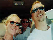
Cat again. We met Stuart, Ryan and Bradley, all of whom had been
aboard since Miami, and had spent the previous 7 or 8 days making final
preparations for the trip, crossing the Gulf Stream and then working
their way through the central Bahamas and down the Exumas chain to
George Town.
We told Mark about our luggage issue, and he
informed us that Bradley wasn't flying out until 3pm the next day, and
that, combined with the fact that we still needed to go to Exuma Market
to restock the boat with essentials for the next leg, would be reason
enough to spend most of the next day in George Town before
leaving. So, we breathed a small sigh of relief and began praying
that our bags would be put on the 7am flight and be in our hands before
we had to set sail.
When the introductions and greetings were behind us
and we had all of our things on board, we cast off the lines and headed
out to the anchorage to spend the night at anchor. Stray Cat has
all the necessary equipment to be self sufficient, and to stay the night
at the dock would have cost $100. Now that's an easy decision.
That night, we settled into the boat and began to
get to know the rest of the crew. Stuart has sailed with Capt.
Mark before on a long trip to the Dominican Republic and has a good many
years of sailing experience. In his shore side life, he is a laboratory
scientist who works on cancer research. Ryan and Bradley are
brothers-in-law who grew up in the same town in Missouri, and took this
trip together hoping for a little adventure. Ryan is an USAF F-16
fighter pilot and Bradley is a professional photographer based in
Hollywood. They were all pleasant and welcoming. We talked
and laughed that night over a few rums and then turned in early to get
enough sleep for the next day, which was likely to be a big one.
The next morning, we were relieved to here
"Stray Cat - Stray Cat - Taxi One" call on the VHF at about
7:15am. Willie had asked Taxi One to call us on the VHF and let us
know he was on the way with our luggage. We eagerly got dressed
and jumped in the dingy with Capt. Mark and motored into Victoria Lake
and the George Town dingy dock. Willie was waiting and walked down
the pier, but there was only one problem - he only had one bag.
Luckily for us, it was the one bag that had the most essentials in it,
so if it had to be one or the other, we were happy to see this
bag. Willie said that the next flight in was at 2:30pm and that he
would be there to check for our other bag at that time. We told
him that we weren't sure if we could stay that long, but that we would
try.
The rest of that day was mostly spent grocery
shopping, stowing groceries, and trying to get Internet. We moved
Stray Cat back onto the day dock to make the days tasks a little
easier. It was a Sunday in George Town, and everything was closed,
except Exuma Market, which only stayed open until 11am. We were
lucky to get there in time and be the last people checking out as they
were locking the doors. Bradley was all packed up and ready when
his 1:30pm taxi arrived. We all wished him a safe trip and watched
him walk down the dock, on his way back to Hollywood.
We were now down to the crew that would
take Stray Cat to Jamaica - A crew of five - Capt. Mark, Mike, Kate,
Stuart and Ryan.
Capt. Mark was kind enough to wait until the next
flight from Nassau came in to see if our other bag was going to make it
in. The 2:30 flight time came and went with no VHF call from
Willie, and we were preparing ourselves for the fact that we were going
to lose that piece of luggage. About 2:45pm, we called "Taxi
One" on Channel 16 and found out that no bag had arrived for us,
and that Willie was sorry, but he had found out nothing. We
thanked him for his efforts, drafted a note with our contact info, and
left it with the local gas station attendant, who kindly agreed to pass
the note on to Willie.
With our business in George Town completed, we made
preparations for departure and by 3pm we were slipping the lines to make
way. We headed East between Stocking Island and Great Exuma before
making the cut out to Exuma Sound. Our direction at that point was
going to be determined by the draft of the boat and the direction of the
wind. We considered a southerly route through Hog Cay cut (DON'T
TALK LIKE A GRINGO TIP #1 - Cay is pronounced "Key" - not
"Kay"), but because that cut is an extremely shallow one, and
the tides were not suitable, Capt. Mark decided to head Northeast for
the northern tip of Long Island.
Another factor in that decision to head up around
Long Island was the wind direction, which was South. The decision
ended up being the right one, because as soon as we rounded the
northeast tip of Long Island we were able to cut the motors and sail at
an average of six or seven knots. The sky was cloudy and we
encountered several squalls full of rain and wind, but we were able to
use each to our advantage by skirting the counter-clockwise sector,
constantly changing course to stay close hauled - not being over powered
or under powered - and keeping the bow to the ever growing swells.
Each one lasted less than an hour - each one soaked us to the bone - and
each one was somewhere between "amusement park fun" and
"close to death terrifying".
This weather stayed with us as we moved down the
coast of Long Island. By this time, night had fallen, and we had
settled into a watch schedule. Stuart and Ryan took the 10pm to
2am watch, and Kate and Mike woke up for the 2am to 6am. We didn't
see a lot of traffic and besides the squalls, not much else.
We continued past Long Island and stayed to the
north of the Acklins on an easterly heading. The wind was still
out of the South and while that was surprising, we were able to use that
wind to make a lot of easting. Our hope was that the trade winds
would fill in eventually from the east making it possible to make our
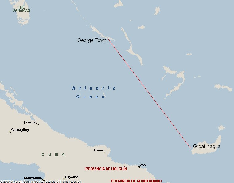
turn south towards Great Inagua.
We skirted the Acklins closely to take advantage of
the lee of the island and the resulting calm waters, and as we made our
turn around the east end, we got our wish. The winds began to blow
out of the east, and we trimmed the sails accordingly, hoping for a free
ride to Matthew Town.
With wind dictating
much of our route, we weren't sure if we would need to stop
or not, how far out of our way it might be etc.... The east winds
fell off and became more southeast, and as a result, we ended up
motoring more than expected. Capt. Mark thought it would be prudent to stop
for fuel before continuing to Jamaica. Mark had never set foot in Matthew's Town, but had
anchored just off of it many years ago. None of the guide books
for that area had any information at all on Matthew's Town and Capt.
Mark had remembered that they may have fuel, but it would have to be
carried in jerry jugs.
Our first stop since George Town and we pulled in
to anchor 2 miles around the island from the point of Matthew's Town at
10pm Tuesday. We had been underway for 2 days and 6+ hours.
It was really not bad to go such a long way, because we had so many
people to stand watch. We did hit some really bumpy seas and that was
about the worst of it.
Early the next morning we were up for coffee,
conversation and plantains... Yum! At 10am we weighed anchor
and headed to Matthew's Town. As we got close we called in on the
radio for instructions on entering the harbor. The instructions
were cordial and fairly vague, very Bahamian. After a few minutes
of searching, Mike spotted a range and a narrow crack in a seawall, That
was it! Capt. Mark eased Stray Cat in through the narrow channel,
at 24ft. wide she's a big girl and he gracefully squeezed her
through.
There was a gentleman to greet us and guide us
through the procedures. We informed him that we were looking for a
Starbucks and a Wal-Mart. He had a great sense of humor! He
got us tied off and took Capt. Mark to customs right away as we waited
for fuel. Before he departed Kate asked him about the flamingos
and he told us they were over 50 miles away. We knew we did not have
much time so figured it was not possible.
As we had pulled in to the harbor there was another
boat already tied up - the only other boat there in the harbor.
This was not an ocean going vessel. It was a Larson 32, much like
a Sea Ray, a motor vessel or a speed boat you would call it - something
that you would normally see on a lake. As we
were waiting Capt. Mark's return, the two latino gentlemen from the
Larson came over and asked us where we were coming in from. Ryan
told them from Miami. They said that's where they had arrived from
and we could not believe it. We had traveled through some very
large seas on our way to get to Matthew's Town and we would never want
to see waves like that in such a small craft like they were
in.
These 2 gentlemen, one named Maruzio, we think, had
been rescued by the coast guard only days before. They went on to
tell us how the seas were huge and their GPS had failed. The boat
was being violently tossed back and forth when they ran out of
fuel. They were close to land at the time and almost decided to
swim for the land and try to make it on foot. They were told later
by locals that they would be dead if they had tried it. They did
have an EPIRB on board, a rescue beacon that sends a GPS signal off to
the Coast Guard with your coordinates, and they decided to press the
button. They retold the exciting tale how the chopper was overhead
in 30 minutes. The basket was lowered to take them to safety and
one by one they crawled into it. They told of the wild ride in the
basket and how it flipped and flopped and felt like they were going to
fall out of it. They were soaked to the bone and scared to death,
but alive. The Coasties took them to Matthew's Town the closest
settlement.
Upon arriving in Matthew's Town the men paid a
local in a small aluminum boat to take them back out to the powerboat
with some fuel. They said it was a bumpy and X-treme ride,
that took them 46 miles! They were happy to get back to their
bosses powerboat and made way into Matthew's Town harbor, now in the
Larson 32. They had told us they were trying to deliver their
bosses boat from Miami to Venezuela. They had 2 55-gallon drums
for fuel in addition to the tanks on board. We thought, these guys
are Insane! They had a great story to tell and they were excited
to tell it to us.
Unfortunately, it turns out that these guys had not
checked into The Bahamas at all. You have to clear customs at the
first point of entry or the first land you touch within 24 hours of
entry. They had gotten fuel at 3 other islands in The Bahama chain
and never checked in with customs & immigration. They told us
that 40 police officers, immigration officers and even the DEA came down to meet
them. They were in BIG trouble!! The officers tore
their boat apart looking for drugs. They cut all of the seats,
carpeting and turned everything upside down. As far as we know
they did not find anything, but these guys were told they could be fined
$10,000.00 for not checking in, plus 30 days in jail, and also they
could take the boat and confiscate it. As we left the harbor these
guys were still sweating it out and had been there for 2 days. The
Bahamas is not the quickest pace to start with, that is part of the
attraction, but in the case of these 2 guys there was definite foot
dragging going on. Who knows maybe we'll see them again on our
journey.
Before we departed Matthew's Town we were able to
fuel up, find an internet cafe next door and were taken to see the
flamingos. We saw the beautiful pink birds from a distance.
We also saw a young couple of feral donkeys and learned that they had
wild cows, goats, donkeys etc... on the island from folks who had
lived there hundreds of years before. They have many fresh water
sources on Great Inagua.
It was strange that the latin men and everyone else
that we asked told us there was no market or store on the island and as
we went to see the flamingos we passed 2 stores a bakery and a liquor
store. It seemed no one wanted our business and we did not get to
explore much of this beautiful town.
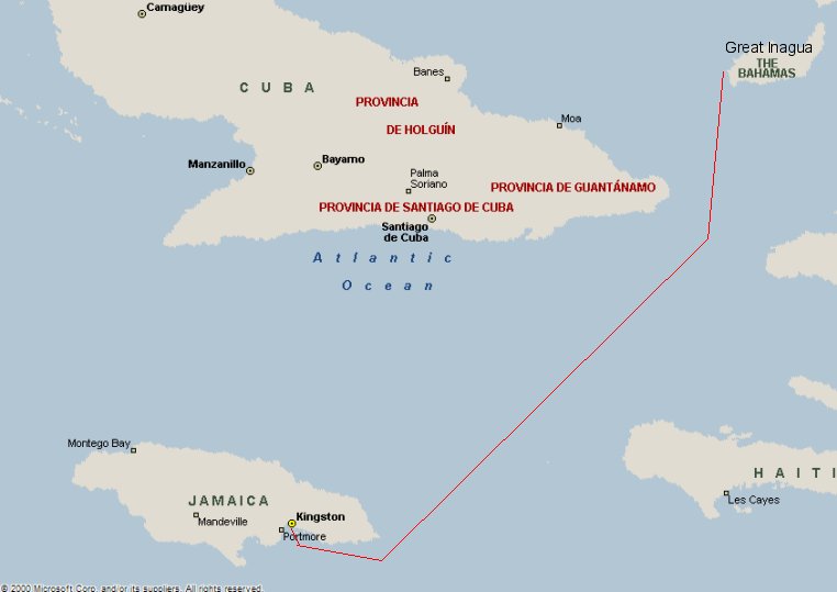
We set sail on Wednesday at 3pm for a couple of
days sail to Jamaica-Mon. We passed so close to Cuba you could
smell the cigars. Down through the Windward Passage we go between
Cuba and Haiti, Travelin' South.
The crew & Capt. Mark have been great.
The camaraderie is evident and everyone is chipping in. It has
been a truly win-win experience with a great bunch of people! God
is Great!
------------- UPDATE -
September 22, 2007 -------------
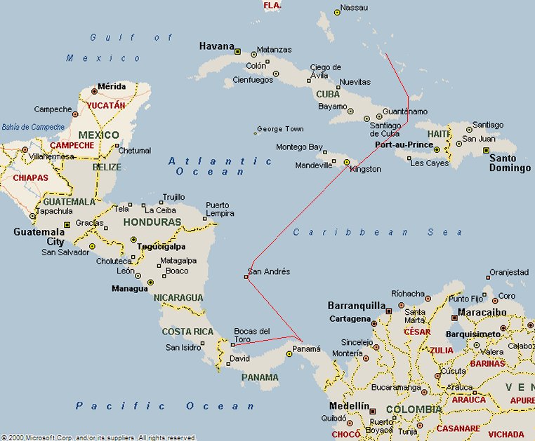
On September 29th, we fly out of New Bern, NC on
our way to George Town, which is on the island of Great Exuma in the
Exumas chain of the Bahamas. It’s sure to be one of those travel days
that never fades from your memory. We are scheduled to change planes
four times – first in Charlotte, then to Ft. Lauderdale, where we
transfer to a Bahamas Air flight bound for Nassau. After a six-hour
layover in Nassau, we’ll jump the evening flight to George Town,
arriving there at approximately 7:15pm. We're hoping to catch a taxi from
the airport to a place called Coco-Plums Beach Club, which we visited on
our last trip to these islands. They are the proud creators of a
cheeseburger, which has been rated #1 on both mine and Kate’s lifetime
list of “Best Cheeseburgers Ever”.
The past few weeks have been hectic to say the least. We have been doing
a lot of asset liquidation with the ultimate goal of getting down to the
bare necessities of life. Believe it or not, Tomorrow is even up for
sale, but we won’t let her go cheaply. If she doesn’t sell while
we’re gone, we’ll be more than happy to have her, but if someone
wants her badly enough between now and then, we’ll be happy to make
the exchange.
Hopefully, after the #1 Cheeseburger in the World, we’ll grab a taxi
into George Town and meet up with Capt. Mark and Stray Cat, a 45’
Privilege catamaran. Probably the next day, we’ll weigh anchor, and
begin our journey south, ultimately heading for the San Blas Islands of
Panama. The route will take us offshore, through the Windward Passage
between Haiti and Cuba, and then on to Jamaica. We plan to pull into
Kingston, Jamaica for a day or two to rest and take on provisions and
fuel. When the weather allows, we’ll make the decision to continue
south for the last offshore leg to the San Blas Islands, a distance that
should take 2 or 3 days to cover.
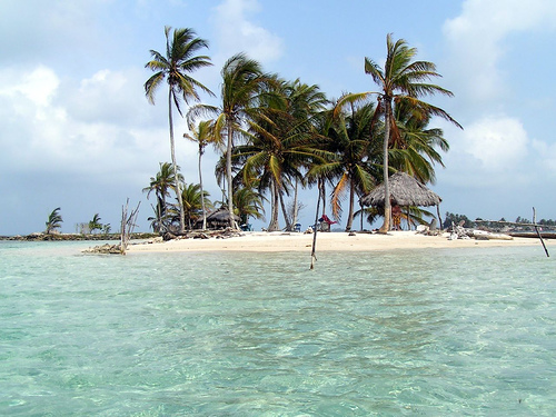
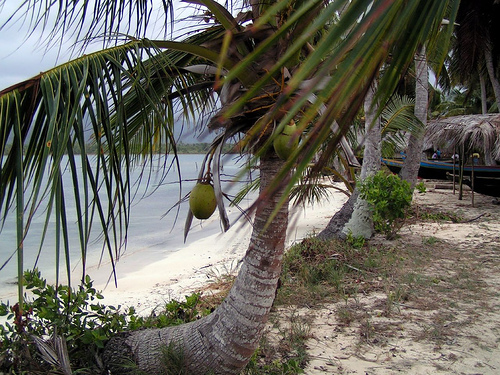
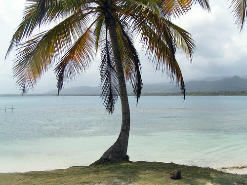
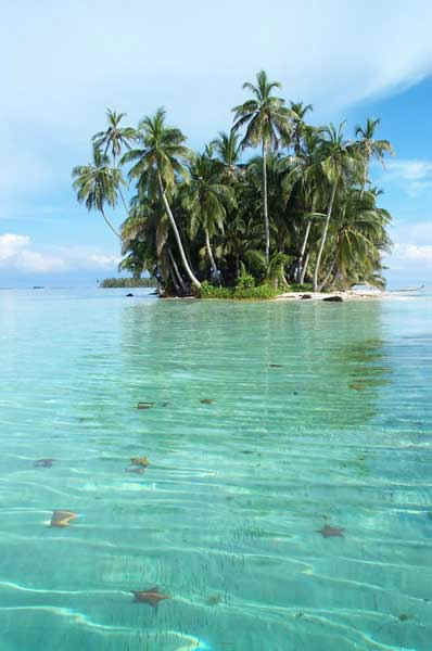
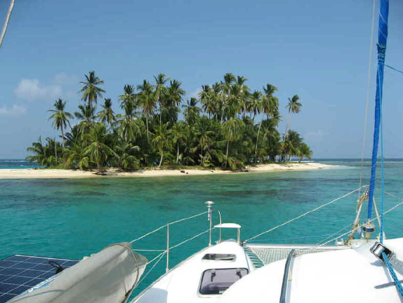
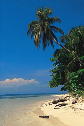
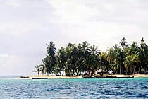
The San Blas are renowned for their tropical beauty, palm tree studded
islands, white sand and turquoise blue waters. They are also famous for
the indigenous Kuna Indians, who still live according to their
generations old traditions and legal codes. The country of Panama even
recognizes the sovereignty of their nation and their laws. They are
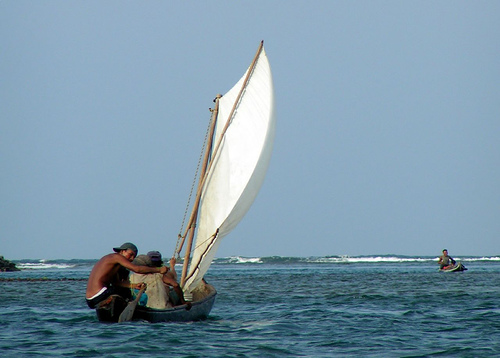
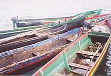
famous for paddling out to meet visiting yachts in their dugout canoes
with the desire to trade fish, coconuts, and most famously, the colorful
“molas” that are crafted by the Kuna women and children.
We plan to explore San Blas for several weeks before making our way to
the Bocas del Toro province of Panama where we will be based for several
weeks. Past that point, the schedule is relatively open, and as sure as
anything CAN happen, we are sure that many things WILL happen.
We’ll do our best to update this blog and our website with reports and
pictures so that you can all go on a “virtual adventure” without
ever leaving your computer screen.
In return, we only ask for your thoughts and prayers for a successful
and safe voyage.
All the best,
Mike and Kate.
|
Hi to everyone,
Here is an update to the upcoming Adventure Sail itinerary,
My original sail plan was to depart from Miami, sail through the
Bahamas, to Jamaica, and from there, offshore to Panama. Several
readers have contacted me and warned me away from Jamaica because
of the ever-increasing crime problem. I then changed my tack and
began planning to head from Miami to Key West, then to the
Yucatan, and down from there to Panama.
After Reading lot’s of books and after finally getting my hands
on a set of pilot charts for the region and time of year, I
discovered that it was a good plan, until one arrives in Honduras
and wishes to go on to Panama. At that point, the trades and
currents will be predominantly on the nose, making for near
impossible conditions.
The plan is now (and won’t change) - Leave from Miami, make our
way down through the Bahamas to Great Inagua Island, then proceed
offshore to Kingston, Jamaica. After a two-day rest, provisions,
fuel and maybe some careful sighting we will go off shore again to
the San Blas Island archipelago of Panama.
The dates, miles and times are dictated by wind and weather, and
can be off by a day or two; However from Miami to George Town they
should be right on. My planning is based on six knots which will
probably hold true for the Bahamas with its prevailing south east
wind but the rest of the trip should be broad reaching or beam
reaching in the trades with SOG of 8 to 10 kts.
From the day of departure and afterwards, I may be reached by
email while underway through on board equipment (no forwards,
attachments or pictures). Or, if the need is immediate, by
satellite phone: Dial 1.480.768.2500 (welcome to Iridium global
message) then dial 881.631.566.456. You will only be charged for
airtime from your location to Phoenix Arizona. The satellite and
overseas charges will be mine.
All of the settlements or towns in the Bahamas have local
airports. The most convenient airports along our route are Bimini,
Nassau and George Town.
Leg 1
Depart Miami at Coconut Grove September 20th for Gun Cay, the
Bimini chain, Bahamas. This leg involves a Gulf Stream crossing,
60 miles and 9 hours.
We will remain over night then take some time to snorkel a very
nice reef at Cat Cay on the 21st. Depending on crew consensus; we
will start the next leg to Chub Cay after swimming.
Leg 2
Depart Cat Cay for Chub Cay, in the Berry Island chain Sept.22nd,
90 miles 15 hours.
Rest, explore, and swim.
Leg 3
Depart Chub Cay Sept. 23rd for Nassau; 38 miles 6.5 hours. The
trip so far will be considered a shake down with Nassau being a
good stop for any maintenance issues that arise. A crew consensus
at this point to stay over in Nassau or pass on through to Rose
Island 7 miles for the night. There is some very good snorkeling
and beach at Green Cay adjacent to Rose so the crew could elect to
spend an extra day.
Leg 4
Depart Nassau or Rose Island for Staniel Cay, Exuma Islands Sept.
24th or 5th, 78 miles 13 hours. These islands are amongst the best
I have ever sailed. The crew will have some input as
to which islands to visit and how long we stay. No matter how it
plays out we will depart Staniel Cay on the 27th. Staniel
has the grotto that was used in the James Bond movie Thunderball;
if you have never snorkeled in a cave this will take your breath
away.
Leg 5
Depart Staniel Cay for George Town, Exuma Sept. 28th, 115 miles 19
hours. George Town is the most popular of these islands with very
good air travel connections, provisioning, restaurants, Tiki bars
and stunning beaches.
Leg 5
Depart George Town, sailing for Long Island Sept. 30th, on to Rum
Cay 75 miles, 12 hours. Good restaurant, fuel and little else on
this far out lying island.
Leg 6
Depart Rum Cay sailing for Matthew Town, Great Inagua, Bahamas;
October 1st, 185 miles, 31 hours.
This passage should be a beam reach or a little closer to the wind
while southing. Depending on sea state and wind direction we will
likely leave long Island to starboard with Crooked and Acklins
Islands close aboard to port for sixty miles in the lee.
Conditions could be such that this course is altered to make for
the Plana Cays south of Rum then south to Inagua.
Matthew Town is the largest settlement in the southern Bahamas. I
have anchored off of it a few times but I did not have a reason to
go ashore. Basic services and supplies are available with air
links to Nassau if needed for parts or a flight out.
Leg 7
Depart Matthew Town sailing for Kingston, Jamaica October 3rd, 300
miles, 50 hours. This passage makes for the Windward Passage between Cuba on the
Starboard and Haiti on the port hand.
October 5th; thus far we will have sailed approximately 940
nautical miles touching three countries with 116 hours underway
taking 15 days to cover the distance.
Leg 8
Depart Kingston for Isla Porvenir, Panama October 5th, 520 miles 90
hours. This will be a blue water passage with wind, waves and a
half-knot current on the port beam. There are varying currents,
seamounts, banks and bars to deal with.
Landfall at Porvenir will take some planning to make a day light
approach to the vast San Blas archipelago. The island
doesn’t have a settlement but it’s the right place to go
through the formalities of clearing into the country thus avoiding
the hustle of the bigger ports. This is a good place for
departing/arriving friends and guests since they have frequent
flights to Panama City.
The neighboring island of Wichubuala has supplies and is located
about a half mile away. This begins for me an adventure of
discovery of these three hundred Polynesian like islands, its’
people, culture, food, music, rain forests, many rivers and much
more.
I will eventually be making my way to Bocas Del Toro in the North West of
Panama. I will post a newsletter in a few days with more
information about this part of the adventure sail for those of you
who wish to come down and enjoy.
Best regards,
Mark
|
|
|
|
|
|
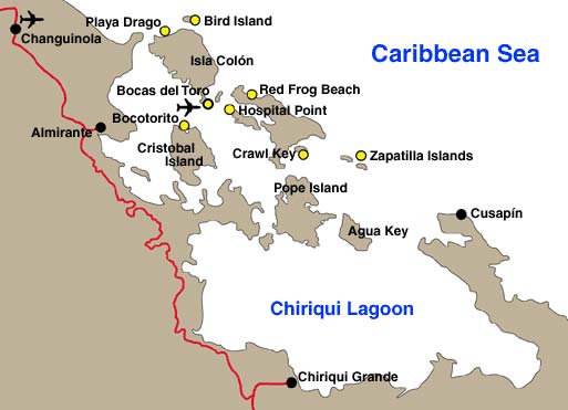
MAP - SAN
BLAS ISLANDS, PANAMA |
|
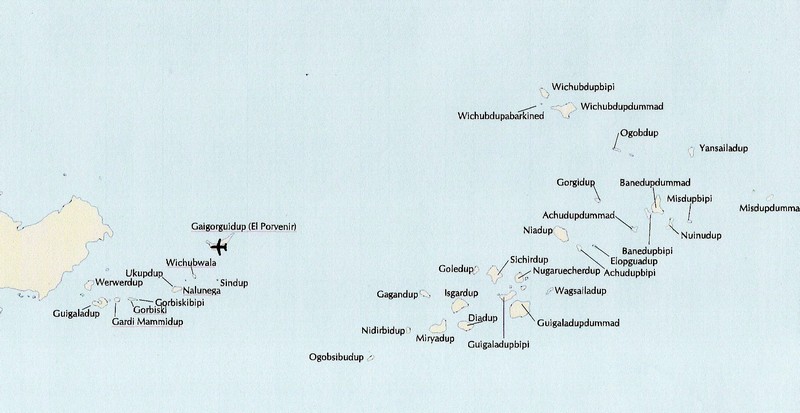
Click
Here for a DETAILED MAP of the San Blas Islands |
| |
|
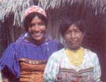
SAN
BLAS ISLANDS - KUNA INDIANS http://centralamerica.com/panama/pansanblas.htm |
|
|
|
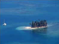
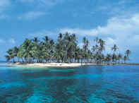
Nestled away on Panama's eastern Caribbean coast is the
breathtakingly beautiful San Blas archipelago. 357 small islands
inhabited by a proud and self-reliant group of native Americans known as
the Kuna. There are daily flights to San Blas from Panama City. Tours
and hotel accommodations can be easily arranged on several of the
islands.
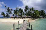
The Kuna are considerate and attentive hosts, preparing wonderful
meals of lobster, crab and fish freshly harvested from the sea and
guiding tourists in dugout canoes to small, uninhabited islands with
gorgeous beaches and pristine coral reefs. Politically independent, the
Kuna won their right to self-government in the Kuna Revolution of 1925,
an historic event that San Blas celebrates every February with the local
holiday of Mor Ginnid. Kuna law prohibits fishing in their waters by
boats with sophisticated machinery or the taking of anything from the
sea that a diver can not reach with air from his own lungs. Scuba diving
is therefore not permitted, but tourists may snorkel in the reef, one of
the oldest and best preserved in the world.
Visitors to San Blas will be treated to a tour of one of the 49
Kuna communities, to observe daily life at first-hand The men rise early
to fish or tend their farms on the mainland, paddling off on their
business in dugout canoes that are sometimes equipped with makeshift
sails. Fresh crab, lobster, octopus and fish, caught with nets or
spears, are exported to Panama City. On their farms, the Kuna men raise
vegetables, fruits, coffee and the all-important coconut, 15 million of
which are exported each year to neighboring Colombia. Coconuts can
actually be used as coins in Kuna commerce and have a value of about ten
US cents. A soda, which costs about 40 cents, can be purchased for four
coconuts on the islands of San Blas!
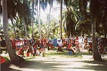
Visitors will also see women at work making molas, the traditional
women's garments. Molas are panels of cloth appliqué, which are sewn
into the fronts and backs of blouses. Mola designs vary from the
abstract and geometric to representations of birds, fish and innumerable
other subjects, all different, but all distinctly Kuna. These works of
art are one of Panama's best-known native crafts and can be purchased in
every town of San Blas. Also available are necklaces of sea shells, and
chaquiras, the bead bracelets used to adorn women's arms and legs.
Visitors may also have the chance to visit a traditional Kuna house,
made of palm-thatched roofs and cane walls, and observe the kitchen and
sleeping quarters.
Towns on San Blas are exceptionally tidy. Public buildings include
schools, health centers and the town hall, a long building with thatched
roof which is the heart of each community Citizens meet daily, except
Saturdays and Sundays, to discuss community affairs, as well as issues
involving neighboring communities and Kuna culture in general. Town
meetings are presided over by the community’s leader known as the
sahila.
Beyond cultural tours and snorkeling, visitors may also accompany
Kuna men to fish, of trek rainforest reserves on the mainland, where
birds and other wildlife are abundant. There are hotels on the islands
of Wichubwala, Nalunega, Ailigandi, Nargana, Achutupo and Carti-Sugtupu,
which also provide meals for guests. Most Kuna communities have an
airstrip, either on the island or the mainland nearby, and are easily
accessible by light aircraft. A visit to these beautiful islands, set
like jewels in the turquoise water of the Caribbean, will be one of the
most memorable experiences of your visit to Panama.
|
| |
|
SAN
BLAS ISLANDS - PARADISE FOUND YachtCrew.com |
| |
|
Paradise FOUND -Yacht
charters in Panama
YachtCrew.com
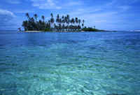
If your idea of paradise is a scattering of islands, many of them
uninhabited, covered with coconut palm and ringed with white sand
beaches, then perhaps you have found it. Paradise. Running from the
Golfo de San Blas to Cape Tiburon on the border of Columbia, the San
Blas Islands lie nestled safely in azure waters, protected on one side
by a reef holding back the waves of the Atlantic Ocean and guarded on
the other side by the towering, tree covered mountains of Panama.
 The
San Blas archipelago lies outside the direct influence of the Caribbean
trade winds, and is south of hurricane threats. Dry season normally runs
from December through April, when bright sunshine prevails and the winds
can blow 25-20 knots. Safe within the protective reef, the islands are
sheltered from the waves and only when a yacht leaves the protected
embrace of the area will it feel the force of the wind-driven water.
Rainy season has drastically reduced breezes and gray skies punctuated
alternately by short squalls and brilliant sunshine. The
San Blas archipelago lies outside the direct influence of the Caribbean
trade winds, and is south of hurricane threats. Dry season normally runs
from December through April, when bright sunshine prevails and the winds
can blow 25-20 knots. Safe within the protective reef, the islands are
sheltered from the waves and only when a yacht leaves the protected
embrace of the area will it feel the force of the wind-driven water.
Rainy season has drastically reduced breezes and gray skies punctuated
alternately by short squalls and brilliant sunshine.
The islands and coastal forest are inhabited by people of the
Comarca de San Blas or Kuna Yala, as they refer to it. They appear to be
little changed from the times before the Spanish Conquista, a direct
result of the legendary tenacity of the Kuna people. According to their
oral tradition, the Kuna’s forefathers lived in the Darien mountains
of Panama. It is believed that they numbered between 500,000 and 750,000
at the time of the Spanish arrival. Whether it was pressure from other
tribes or from the Spanish invaders, the majority of Kunas moved to the
coast and later to the offshore islands.
After suffering from inroads from outsiders, the Kunas rebelled in
1925, killing many Panamanian policemen and children of mixed blood
living in the islands. Finally, in 1938, the government of Panama
granted the Kuna leaders almost autonomous control. Even today, the Kuna
Indians pay no taxes to Panama even though they are allowed to vote in
all Panamanian elections. The Carta Organica, the Kuna constitution,
sets the governing principals for the three districts of Kuna Yala, each
district is headed by an elected cacique, or high chief. The Kuna nation
consists of 49 communities which are home to about 50,000 Kuna Indians
today.
Each community elects their own chief, or sahila (pronounced
sigh-la) that presides over the local daily congresso., The daily
congresso is held in the afternoon in the large council house located on
the island. The chief swings in his hammock while everyone else is
seated on wooden benches. A complex system of laws exists, with an
equally complex system of punishment existing for ignoring or breaking
the laws: from fines to being made to sit on a very tiny chair during
the daily congresso, to ostracism or even expulsion.
Permits are necessary for seemingly everything, including visiting
another village. Of the 49 communities, approximately half are headed by
women sahilas. The Kuna society is matrilineal, with new husbands moving
into the wife’s compound. The law dictates that the land belongs to
all Kunas. This has the benefit that all of the people perceive
themselves as co-owners of the islands and the mainland which is Kuna
territory.
However, the coconut palms on the islands are all individually
owned and the coconuts harvested from the trees provide cash. The Kuna
women have their own source of cash...the making and selling of molas.
Each mola is an intricately worked reverse appliqué design, measuring
from 4” X 4” for small molas to 2’ X 2” for larger ones. Prices
depend on the size of the mola, the number of layers and the size of the
stitches, anywhere from $1 to several hundred dollars per mola.
Traditionally, the women wear them stitched to the front and back
of their blouses. They also create strings of tiny beads, which when
wrapped on wrist or leg, create intricate patterns and designs. Another
source of cash comes from the “one dollah” to take their
picture...so when you go to these wonderful islands and want to take
pictures of these beautiful people and their children, bring plenty of
single dollar bills! Any time a boat anchors near one of the islands, it
is sure to be greeted by at least one (usually more) dugout canoe with
Kuna women ready to sell you molas, the men with coconuts, fish,
lobsters and sometimes vegetables.
Often the whole family is in the dugout, including the grandma,
children and dog! The canoes are sometimes powered by an outboard
engine, but even more often it is paddled with hand-made wooden paddles.
The constant use of the canoe produces expert boat handlers and extreme
stamina, as the dugouts are neither light nor graceful. Perhaps because
of this relentless strength, the Kuna people have maintained their
reputation as fierce warriors and even today, squatters fear to intrude
on Kuna territory.
 As
a result of their fierce reputation, in a world of shrinking rain
forests, the land of Kuna Yala is a notable exception. Kuna huts consist
of reeds or canes to form their sides and palm fronds thatching the
roof, so no hardwoods are needed for their construction. A small number
of trees are used for the making of the dugouts, but the hills remain
densely wooded. Farming is subsistence level and cattle are not raised,
so the forests will stand for years to come, safe in the care of the
Kunas. As
a result of their fierce reputation, in a world of shrinking rain
forests, the land of Kuna Yala is a notable exception. Kuna huts consist
of reeds or canes to form their sides and palm fronds thatching the
roof, so no hardwoods are needed for their construction. A small number
of trees are used for the making of the dugouts, but the hills remain
densely wooded. Farming is subsistence level and cattle are not raised,
so the forests will stand for years to come, safe in the care of the
Kunas.
The Kuna Indians are a friendly people inhabiting beautiful,
fascinating islands and coastal lands that beckon you to explore them.
How many islands make up the San Blas archipelago? Depends on who
is telling you, but the numbers run anywhere from 243 to the oh-so-very
convenient number of 365, one for each day of the year. Obviously, you
won’t have time to visit them all, plus some interesting places on the
mainland territory of Kuna Yala, so we will introduce you to a few
delectable choices here. The north part of the San Blas Islands are
defined by Punto San Blas, an arm of land reaching out from the
mainland, as if striving to touch the islands so close to it, wrapping
the Golfo de San Blas in its protective embrace.
The island of Porvenier lies a short distance from the end of the
Punta San Blas and features a small airstrip, which is an excellent
place for guest and charter yacht to rendezvous. While Porvenier has no
village, immediately to the south lie Wichubhuala and Nalunega. The huts
are so close together and so near the waters edge, that viewed from the
sea, they appear to be holding onto each other to keep from spilling
into the ocean. Plenty of molas and other crafts for sale, with
bright-eyed children everywhere, some shy and curious, others wanting
you to take their picture for the inevitable “one dollah”.
The Chichime Cays lie about 4 miles to the northeast of Porvenier
and have become so popular with visiting yachts that the Kunas sometimes
call them Puerto Yate. They have no village, merely a few huts scattered
in the thick groves of coconut palms. There is a deep pool between the
islands, protected by a shallow reef that extends toward the ocean.
Excellent snorkeling is to be found on the lee side of this reef.
A bit further to the north and east of the Chichime Cays lie the
Holandes Cays, Kaimon in Kuna. There are sixteen palm clad islands,
wrapped by sugary white sand beaches, drifting in the clear protected
water of a seven mile long area of fringing reef. Divers and snorkelers
might never be enticed back out of the water, once they have experienced
this enchanting area. However, divers should note: fishing is strictly
prohibited while on scuba. Beyond the Holandes Cays lies the Coco
Bandero Cays.
They continue the “perfect island” phenomenon of small
islands, azure waters providing the perfect setting for these jewels,
each more stunning than the last. The biggest problem is deciding which
one to visit next. Tearing yourself away from the outlying islands, you
will surely want to return to the Punta San Blas and explore the inner
islands, plus some of the delights to be found on the mainland territory
of Kuna Yala. Sheltered under the arm of Punta San Blas is Tadarguanet
Island, Kuna for “where the sun sets”.
Tupsuit Dumat (also called Alitupu) is a good base for exploring
the nearby rivers on the mainland, there are two that are worth
exploring. The first is Rio Torti, with a cemetery on the right, almost
as soon as you enter. Kuna cemeteriea are usually close to the rivers.
Thatched roofs on poles shade the deep clay graves where the deceased
are buried in hammocks, accompanied by everyday utensils for the
afterlife. The other river is Rio Mandinga, noteworthy because of its
vast number and variety of birdlife.
Nurdupu lies to the east of the Tadarguanet islands and almost
directly south of Porvenier. Nurdupu has all the aspects of the perfect
tropical island. Huts are in shady spots under breadfruit trees and
coconut palms. Many of the coconut palms have been pierced to take the
levers of sugar can presses to make the juice for chichi. Chicha is a
mild alcoholic drink from fermented sugar cane juice. Collecting the
cane, pressing the juice and then several days of tasting the fermenting
concoction terminates in two or three days of celebration, such as the
Kuna Independence Revolution Day.
Rio Sidra, though sounding like a river, is actually an island
consisting of two villages, Mamartupu and Urgandu. Both villages have
their own chiefs. Also of interest is that Rio Sidra is heavily
populated and has an airstrip which receives several flights a day,
making it an excellent place to start or end your charter. Rio Diablo
lies further east and is home to not one, but two airstrips. The name of
Rio Diablo is found on the charts, however, the two villages comprising
the bridged community. One is known as Naragana in Panamanian and Yandup
in Kuna, the other is Corazon de Jesus in Panamanian and Akuanusatupu in
Kuna. Just a bit confusing!
Extensive outer reefs smooth the inshore waters from Punta Brava
to Achutupu. Within these protected waters is Airligandi, a heavily
populated island with several restaurants, a hotel and a clinic. The
nearby river of Rio Nasadi is a nice excursion, with its large stands of
bamboo and mango trees to wander through. Continuing down the coast, one
comes upon Ustupu, the largest village in San Blas.
 Home
to about 8,000 people, not counting children, with a bridge connecting
it to Ogopsukum, home to an additional 2,000 inhabitants. Several flight
a day land on the two airstrips, one located on the island and the other
on the mainland. Sugandi Tiwar is a nearby river that should bwe
explored. Its estuary is marked by the hulks of giant trees washed down
during the flood of 1925 which forced the village to move from the
mainland to Ustupu. Home
to about 8,000 people, not counting children, with a bridge connecting
it to Ogopsukum, home to an additional 2,000 inhabitants. Several flight
a day land on the two airstrips, one located on the island and the other
on the mainland. Sugandi Tiwar is a nearby river that should bwe
explored. Its estuary is marked by the hulks of giant trees washed down
during the flood of 1925 which forced the village to move from the
mainland to Ustupu.
There are large cemeteries on both sides of the river and in the
afternoon hours, the bird activity is positively raucous. The Kunas call
Isla Pinos: Tupbak, or “whale”, for its resemblance to a giant
beached whale. For centuries the 400’ high island has served as a
landmark and landfall for mariners. This protected yet easily entered
and exited anchorage made a perfect base for buccaneers working the
Spanish Main, especially the gold transport shipments. Later, new
England schooners would come to purchase coconuts. Today, yachts
continue to enjoy it and visit the two villages located there.
Sukunya is the Kuna word for the small penisula that the Spanish
called Punta Escoses. Escoses is the Spanish word for “Scottish”. In
1698 the Scotts attempted to establish a colony there, starting with an
expedition of 1200 people. Defeated by starvation and disease, they
returned home, passing two ships carrying reinforcements from Scotland.
They too, gave up and returned to Scotland in 1702. Of the 2,800 people
involved, over 2,000 perished. Only a boat channel hacked out of the
coral limestone and a length of moat remains of what was once Fort
Andrews.
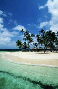
Today, the San Blas Islands wait to be discovered and explored.
Perfect tropical islands, winding, shaded rivers, protected azure
waters, history, dense rainforests, friendly people...the San Blas
Islands and the territory of Kuna Yala. Paradise Found.
|
SAN
BLAS ISLANDS - INSIDE INFO ExplorePanama.com |
| |
| The
San Blas Archipelago is composed of approximately 100 nameless islets,
113 with names and nearly 30 islands all coralligenous. You could spend
almost an entire year traveling through the insular area of each one.
There are no roads into the region, but small planes fly to more than a
dozen landing strips daily. Panama City tour operators can arrange
overnight stays, which is recommended. Off the northeast coast of
Panama, palm-lined beaches, coral-ringed islands and jungle-cloaked
mountains make San Blas look a lot like paradise, but the main reason
for going there is to spend time with the Kuna Indians, who have managed
to protect their unique culture. They live in thatched huts on about 40
of the 350 islands of the archipelago and rule their own autonomous
province.
Inhabitants of
the San Blas Archipelago live at the Mulatas' Archipelago or San Blas
and at the Bayano and Chucunaque rivers basins. They are of Caribe
origin, small in stature, short neck and big head, broad backs, strong
chest, short legs and small feet. They dress moderately. The Kuna women
still wear long skirts, red and yellow headdresses, appliqued mola
blouses with showy colors. They wear gold earrings and a ring in their
noses, keep their traditions and legends, their beliefs and myths, and
their Gods.
Inhabitants of
San Blas believe in superstition. Their language is rich and vast. They
practice monogamy and adultery is a felony. Their leader is the Sahila
who has authority on the community in which he lives. The Nele is the
leader of several communities. They practice agriculture and cultivate
coconut which is their main staple and which they have for sale.
Although they cultivate corn, rice, cocoa and yucca, essentially they
are fishermen. The National Government provides elementary schools for
them and also a Junior High School at the Nargana Island. The adventure
at San Blas could be a stay at an uninhabited island, a fishing tour,
dancing and traditional rites, diving and submarine fishing, the
enjoyment of the crystalline waters or merely the peace of a hammock
swung by the wind or to get a tan.
Though they
maintain their traditions, the Kuna have also become adept at modern
business practices: The region's six hotels are owned and operated by
the tribe, and all offer visits to nearby villages and snorkeling
excursions. A newer hotel on the island of Kuadule offers private
oceanfront huts and meals cooked by Kuna women. Business even comes to
bear on any photos that you take of the Kuna: On most islands, you'll be
expected to pay US$1 for each person in the photo.
Flight depart
from the national airport in Panama City everyday at 6:00 a.m. to
Porvenir and to several other islands, as far as Osbaldia Port. Flights
return around 8:30 of the next morning. If you wish to go by road, take
the Inter-American route toward Bayano; at the point of El Llano, Chepo,
the route leads up to Carti in the middle of the San Blas coast, from
there, canoes can be rented in order to make connections with the
insular region.
San
Blas Islands
El Porvenir- Seat of the Region
The regular
weekly flights arrive on this Island. It is the strategic point to
obtain more detailed information in connection with the kuna culture and
the services offered by other islands. At Porvenir there are beaches and
it is the administrative center for the governmental offices. Seat of
the Region's Intendency. From here you may move to nearby islands. Even
reaching Obaldia's Port, Panama's lost boundary with the Republic of
Colombia.
Nargana
There is the Nargana Lodge Hotel. The island connects with another town
through a wooden bridge, politically divided, known as Jesus' Heart (Corazon
de Jesus), that is to say, it is an island that has two towns. These are
two communities quite accustomed to other cultures, bilingual, men as
well as women wear western clothes. Both towns are managed by the
Sahilas. Presently these communities do not practice their rites, nor
play their traditional instruments. They do not have much native things,
however, its general aspect is quite pleasant because of its straight,
clean and sandy streets. Traveling 15 minutes by canoe, you may visit
Tigre Island, a very traditional island; women still wear Molas and they
practice their traditional rites. The best typical dancing groups, well
organized, are at Tigre Island. The inhabitants still make their
handicrafts, to offer them to the tourists staying at the Nargana Hotel.
Wichubwala
The entire Archipelago favors tourist attention, but' the best services
are found on this beautiful island. Here is the Anal Lodge; San Blas'
best hotel. It has bungalow-type lodging, a marine pool with lobsters,
it offers fishing trips or adventures to inhabited or uninhabited
islands, diving or submarine fishing equipment are rented except for the
oxygen tanks. It is worth mentioning that in the entire region there is
no place to rent or fill up your oxygen tank.
Nalunega
Island
Its name means 'Snapper Island', it is very attractive and its houses
are traditional. This community takes advantage of the services of
Porvenir Island.
Carti-sugtupu
We find the hotel which carries the some name of the island, and which
belongs to the town. At Cartil there is radio-communication, post
office, library, junior high s school, two docks, electricity, small
shops, bakeries, a Catholic Church, a basketball court, health center
and an airport on solid ground.
Ailigandi
Offers the services of the 'La Palmeco' Hotel, This community has a
modern hospital, basketball courts, modest restaurants, shops, churches,
airports on solid ground, post office, radio communication, plumbing,
electricity, and a local Congress House. The hotel is a concrete, one
story building, with a restaurant and a bar; it is property of the town
cooperative society.
Special
Events
| February |
PLAYON
CHICO, TUPILE, AILIGANDI AND USTUPU Tule Revolution Anniversary.
They present a dramatic feather of post battles, typical dances
and drink fermented beverages. |
| March
19 |
NARGANA
Patronal festivities in which western style dances are
performed, there are regional and national dishes, there are
also basketball competitions. |
| July
8 |
MULATUPO
Inokina Anniversary. Typical dances and dishes, games and
speeches. |
|
| July
29-31 |
FULIPE
Patronal festivities, western style dances as well as typical
dances, regional dishes. |
|
| August
20 |
NARGANA
Charles Robinson Anniversary. Western style dances as well as
typical dances, regional dishes. |
|
| September
3 |
USTUP0
Nele-Kantule, Dances, dishes, speeches, deceased eulogy. |
|
| September
1 |
TUWALA
Yabilikiña Anniversary, dishes, typical dances, sport games and
speeches. |
|
Services
LODGING
El
Porvenir
El Porvenir Hotel: 13 rooms. Tel: 221-1397
Nalunega
Island
Hotel San Blas: 31 rooms, kuna style, 3 daily meals, tours around
inhabited and uninhabited islands. radio communication. Tel: 262-5410
Wichub-Wala
Island
Hotel Anai 20 rooms, Wooden floor and cane walls.Tel:239-3025.
Kuna Kishua Hotel. Five basic rooms. Tel:227-5308
Sugtupu With cabin like aspect, wooden floor and cone walls.
Ailigandi
Island
La Palmera One story concrete building, With restaurant and bar. It
belongs to the Town Cooperative Society.
Hotel Nargana 10 rooms; communication by radio. Hotel construction Kuno
style.
Achutupo
Island
Hotel Uaguitupo Cabins, restaurant, Bar.
Kuanidup
Cabins, restaurant, bar.(Sidra River).
Iskardup
Cabins, restaurant, bar.
Kwadule
Eco-resort. 6 stand-alone cabinas and large restaurant. Tel: 269-6313
|
| |
|
|
MAP - BOCAS
DEL TORO, PANAMA |
|
|
| |
|
USA
TODAY ARTICLE - BOCAS DEL TORO, PANAMA |
|

|
Paradise
off the coast of Panama
By Mike Madden,
Gannett News Service
BOCAS DEL TORO,
Panama — When Liza Belkin and Brian Steele told friends they'd
be going to some small Panamanian islands for vacation in
December, they got only one question: "Why?"
But
once the Palo Alto, Calif., couple arrived at this Caribbean
archipelago dotted with lush jungles, white sand beaches and
protected coral reefs, they had a ready answer.
"This
is awesome!" says Steele, 30, a marketing executive. |
Long overshadowed by eco-tourism heavyweights
Costa Rica and Belize to the north, Bocas del Toro is starting to emerge
as the newest star in the eco-tourism pantheon. Guidebooks and promoters
tout the islands as "the Galapagos of the 21st century."
Hundreds of species of fish, parrots, toucans, monkeys and sloths live
on the islands, which include a 20-year-old national marine park to
protect endangered manatees and sea turtles.
Already a popular destination for vacationing
Panamanians from the mainland, Bocas del Toro, which means "mouths
of the bull," is a collection of nine islands and more than 200
keys sprinkled about 25 miles off the coast near the Costa Rican border.
Christopher Columbus named the archipelago, which today counts 10,000
residents, in 1502 when he landed on Isla Carenero, the smallest island.
American banana companies built the main settlement, known as Bocas
Town, on Isla Colon, the largest island in the chain, not long after
Panama declared independence from Colombia in 1903.
But with its rustic facilities and
end-of-the-line feel, it's not for everyone. Now, as eco-tourism
increases, Bocas Town, with only 1,200 people, feels like a sleepy beach
place poised on the verge of a big boom. The government-run Panamanian
Tourism Institute has started promoting the islands to U.S. travelers,
launching an English-language Web site that features Bocas prominently.
With an airport, Internet cafes, ATMs and
plenty of hotels and restaurants, Bocas Town has enough infrastructure
that visitors have no problem quickly making themselves comfortable.
Concrete-and-steel frames for more hotels seem to be popping up
everywhere, and a Bocas Business Association, with a big sign in
English, sits prominently on downtown's main strip, Calle 3. The
official currency is the dollar, the legacy of U.S. involvement in
Panama, and most stores and restaurants accept credit cards. Many
merchants speak English as well as Spanish.
But chickens and roosters still strut the
unpaved side streets with impunity, and the chirps of tropical birds
often wake tourists well before the alarm clock rings. Most of the few
cars are taxis, and pedestrians stroll down the center of Calle 3. Palm
and banana trees provide shady spots. The islands are still wild enough
to have hosted the Italian and Russian versions of Survivor.
"It's kind of rough around the edges,
which we like," Steele says.
Getting around the islands is easy. Touts for
boat companies wander the streets, offering to ferry tourists to less
developed spots in the archipelago. Once out of town, the biological
diversity sparkles. Mangrove forests bump up against beaches with coral
reefs just offshore.
On Isla Bastimentos, a 10-minute ride from
town, a little village of brightly painted open-air huts and cheap
hotels sits at the foot of jungle-covered hills. Tourists can take a
20-minute hike through sunny meadows and down muddy paths to Wizard
Beach, a nearly deserted slice of white sand between warm turquoise
water and steamy rain forest.
Along the way, ants carry bits of leaves twice
their size across the path. Thick mud oozes underfoot after a common
early morning rainstorm. A jungle-covered hill looms to the north, vines
drooping from the summit almost all the way to the sea. Coconuts fall
from trees at the beach's edge. Surfers willing to lug their boards
through the forest ride rolling waves.
Back in the village, tourists sip beers and
listen to reggae music under a thatched-roof bar where water taxis dock.
In Dolphin Bay, boats circle to watch
bottlenose dolphins surface, although there are too many jellyfish to
swim alongside them. Perfectly clear water covers a sprawling reef at
Coral Cay. Barracuda lurk as snorkelers watch white snappers, angelfish
and other species in dazzling shades of yellow and blue.
From there, a short boat ride ends on
Bastimentos, where another hike goes through forests teeming with rare
poison-dart frogs. Bright red and not much bigger than a thumbnail, they
dart from one leaf to another. (They're only dangerous if handled with
open cuts.) At the end of the trail is Red Frog Beach, less empty than
Wizard Beach but just as relaxing.
Another popular snorkeling stop is Hospital
Point, where an enormous variety of sea life clusters along a coral reef
at the edge of a 60-foot underwater cliff. Live sponges mix with coral
on the seafloor. Eels slither alongside crabs and tropical fish. Guides
can provide snorkeling equipment.
Over the past couple of years, some lodges
devoted specifically to eco-tourism have opened outside Bocas Town, with
private beaches and snorkeling spots.
Still, until more development comes, visiting
Bocas may take a slightly more adventurous spirit than a trip elsewhere
in the Caribbean. But for many who come here, that's exactly the draw.
"Our clients that choose Panama want
something that is off the beaten path," says Denise Page with Lost
World Adventures, a Decatur, Ga., travel agency that has booked trips to
Bocas for eight years. "It's people who are more well traveled and
comfortable going to places that are off the beaten path. That's what
they seek."
Getting there: American, Delta and Taca are among airlines that
serve Panama City. Taca subsidiary AeroPerlas runs two one-hour flights
daily from Panama City to Bocas del Toro for $100 round trip.
IMPORTANT TIPS TO KNOW.....
 Getting around: Taxis from Bocas del Toro airport to downtown cost about
$1 a passenger. From Bocas Town, boats to nearby islands cost $1 to $2.
Getting around: Taxis from Bocas del Toro airport to downtown cost about
$1 a passenger. From Bocas Town, boats to nearby islands cost $1 to $2.
Where to stay: The ritziest hotel, which is not that ritzy by Western
standards, is the Hotel Swan's Cay (011-507-757-9090; swanscayhotel.com).
Double rooms are $60-$90; larger suites go for $120-$200. Rooms have
cable television and air conditioning, and the hotel pool overlooks the
sea. Out of town, several all-inclusive lodges offer bungalows and meals
including the Al Natural Resort (011-507-757-9004), where
double-occupancy huts start at $100 a night. Punta Caracol
(011-507-612-1088, puntacaracol.com)
is a slightly more upscale eco-lodge with five cabins set on a dock.
Winter rates for two start at $265 a night, which includes breakfasts,
dinners, transfers from Bocas Town and snorkeling equipment.
Where to eat: The Thai/ Lebanese/Mexican/seafood menu at El Pecado da
Sabor may sound a bit strange, but the delicious fresh fish and soups
cooked from scratch come together quite well; about $20 a person for
dinner. Reggae Bar Roots in Bastimentos village serves fresh Caribbean
food and cold beer as the sun sets on the water; $12 for dinner. Om Café
offers Indian twists on Central American staples, including a spicy eggs
vindaloo for breakfast ($7).
What to do: Eight-hour tours around the archipelago start at about $15 a
person at any of the boat companies on the main drag in town. They can
include snorkeling, scuba diving and visits to beaches with a stop for
lunch. Wander past the docks and talk to boat operators until you find
someone you're comfortable with.
|
| |
|
OUTSIDE
MAGAZINE - BOCAS DEL TORO, PANAMA |
| |
| Hundreds of green sea turtles keep a secret from the
tourists who flock to Costa Rica's Tortuguero beaches each summer to see
them nest. On their way north, the turtles migrate through Bocas del
Toro, a luscious collection of 68 Caribbean islands that offer deserted
beaches as well as snorkeling among dolphins, eagle rays, soft corals,
and shallow volcanic tunnels.
Dubbed Veraguas, or Greenwaters, by Columbus, Bocas is now
surrounded by a huge banana-growing belt. The ethnic mix of workers is
so diverse that the archipelago has adopted its own hybrid language,
called Guari-Guari, a mélange of Spanish, English, and at least two
indigenous dialects. The laid-back Caribbean style of life here is
evident in the use of the word tranquilo—the locals' invariable
response when asked how it's going—and in the languid pace of the
water taxis that provide the primary means of transportation. For a few
bucks, a taxi will drop you on an empty beach like those on Cayos
Zapatillas, where you can stretch out on white sand under a coconut palm
all day.
Or you can kick back, as I did, on the veranda of one of the
clapboard guest houses on stilts in Isla Colón's hot spot, Bocas del
Toro town, where plantation workers drink rum and dance to reggae bands
like the Bastimentos Beach Boys. With a three-stringed bassist and a
thumb-strumming guitar player, the ragtag but rhythmically impeccable
quartet played an impromptu session at my hotel one night while I gorged
on lobster-and-crab seviche and rondon, a seafood potluck–style stew.
Bocas fishermen also traditionally hunt green sea turtles for
meat, but Ancon has been working to change attitudes and recently helped
secure protection for 14 miles of nesting beaches (and 32,000 acres of
reefs and mangrove forests) on Isla Bastimentos and nearby islands. For
divers and snorkelers underwater conditions are excellent (except right
after rainstorms, when silty river flow cuts visibility). If you're
certified, head out with Bocas Water Sports to Cayo Crawl, the Garden,
or Hospital Point, a 50-foot wall off Cayo Nancy. Snorkelers can hire
water taxis to ferry them out to the reefs.
Despite the convenience of a 55-minute plane flight from Panama
City, Bocas gets only a trickle of foreign travelers. That's starting to
change, however, and Europeans and Americans have begun scooping up
beachfront lots for as little as $2,000 an acre. Development in these
paradisiacal islands is inevitable, but for the foreseeable future,
unpolished Bocas remains slow, peaceful, and nothing near a resort. |
| |
|
MOON
TRAVEL GUIDES - BOCAS DEL TORO, PANAMA |
| |
| It’s hard to leave Bocas del Toro. It’s a terribly
relaxing place, and at the same time it exudes a funky, romantic charm
that has something untamed about it. The place is filled with colorful
characters nursing drinks in dilapidated wooden bars or running rustic
hotels on remote beaches. It’s the kind of Caribbean hideaway one
expects to find only in old Bogart films.
And it’s just gorgeous. It has an abundance of emerald islands,
pristine beaches, turquoise waters, dense forests, barely explored
mountains and rivers, extensive coral gardens, spooky mangrove channels,
and exotic wildlife. Four species of endangered sea turtles still visit
the waters of Bocas. They come ashore by the hundreds during nesting
season to lay their eggs on the north side of the islands and some
stretches of the mainland coast. Little Swan’s Cay, really just a rock
in the ocean, is the only Panamanian nesting site of the beautiful
red-billed tropicbird. It’s just one of the more than 350 species of
birds attracted to the region. Sloths, caimans, dolphins, neon-colored
frogs, and, of course, lots of small tropical fish are easy to spot in
the archipelago. No wonder a dozen countries have shot their versions of
the Survivor TV series here.
The people help make Bocas special. More ethnicities and
nationalities are represented on the islands than anywhere in the
country outside of Panama City. And one is more likely to hear English
spoken here than anywhere in the country, period. The islands have long
been home to the Ngöbe-Buglé, as well as the descendents of
Afro-Caribbean immigrants from the English-speaking islands of Jamaica,
San Andrés, and Providencia, many of whom came down to work on the
region’s enormous banana plantations. Most of the hotels and
restaurants on the islands are owned by Europeans and North Americans.
And the mostly young and boho tourists Bocas attracts are coming from
all over the world.
For most visitors, Bocas del Toro means the archipelago that
stretches about 100 kilometers from Boca del Drago in the west to Isla
Escudo de Veraguas in the east. For them the mainland is just a place to
fly over or drive through on the way to the islands. But the rest of the
province of Bocas del Toro has plenty of spectacular natural beauty,
such as the Caribbean side of the enormous Parque Internacional la
Amistad and the wetlands of San San Pondsack. Lucky hikers, at least
those who venture far up into the mainland forests, may encounter
endangered mammals such as Baird’s tapir. All five species of cats
found on the isthmus, including jaguars, are hanging on in the most
remote reaches of the forest, but the chance of coming across one is
slim. The forests are also still home to indigenous peoples trying to
hold onto their culture and ancestral lands. This includes the
little-known Naso, who welcome visitors to a unique eco-tourist project
on the edge of their communities up the Rio Teribe. |
| |
|
PHOTOS
- BOCAS DEL TORO, PANAMA |
| |
|
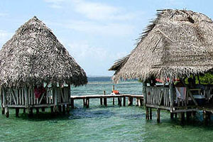
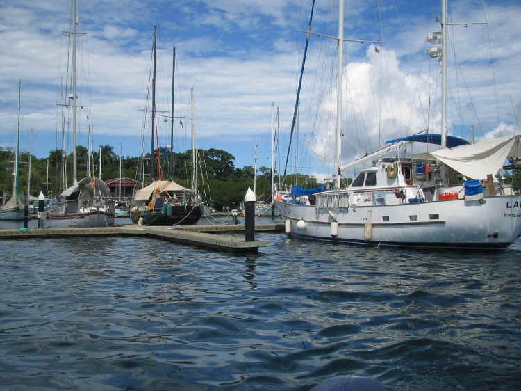
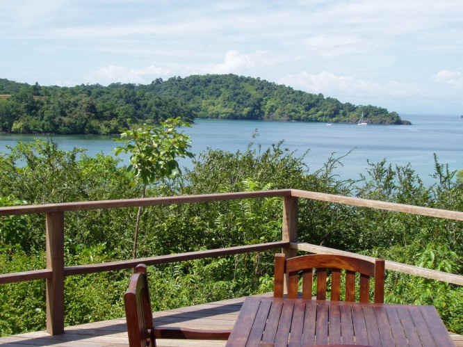
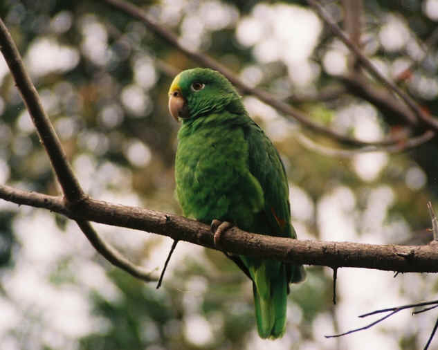
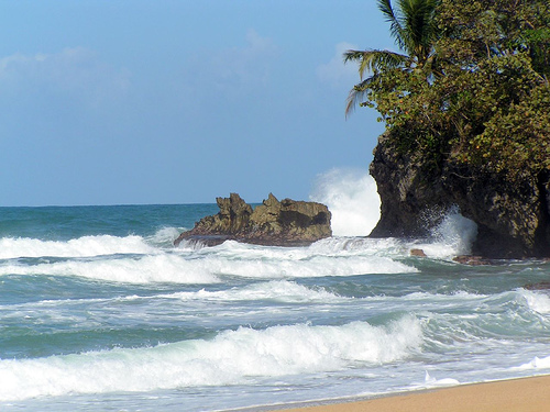

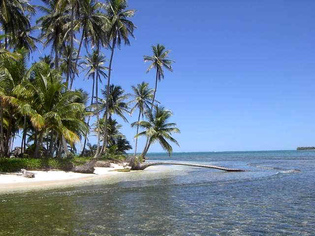
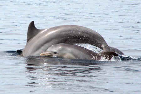
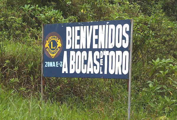
|
|